
 Explorers
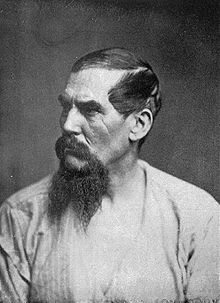
If you get a moment take a look at the movie called Mountains of the Moon. This 1990 movie recreates the exploratory journeys of Sir Richard Francis Burton (Patrick Bergin) and Lt. John Henning Speke (Iain Glen). Their goal is to find the true source of the Nile river in the name of Queen Victoria’s British Empire.
If you want to go deeper, try reading the well-written book Captain Sir Richard Francis Burton by Edward Rice (1990), because it will engage you for hours. The book by Rice is likely one of the most comprehensive biographies ever written on Burton and his travels through Africa, India, Italy and far more.
Tim Jeal covers the journey of explorers Burton and Speke in his book called, Explorers of the Nile. Jeal notes the old Latin saying, “Facilius sit Nili caput invenire: “It would be easier to find the source of the Nile.” was stated for a reason: no one could find the elusive spot. Many explorers, geographers and astronomers tried to find the source of the Nile. Men such as David Livingstone, the Moroccan Berber traveller Ibn Battuta (1304-68) and James Bruce all made attempts. It would be 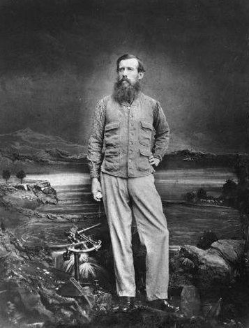 who would achieve the distinction in 1858 but it would come with a price.
The Royal Geographical Society (RGS) was keen on solving the mystery and so Burton and Speke decided to take up the RSG’s proposal and explore the uncharted territories. During their travels they would attacked by local tribes, both become deathly ill and lose much hope of finding the source of the big river. On one of the most interesting pages of Rice’s book, he recounts Speke’s encounter with a beetle that has entered the explorer’s ear.
-Exhausted, Speke went to sleep with them crawling over his person, only to be awakened by one of the “horrid little insects” struggling into his ear. Trying to remove the beetle only pushed it in further. The beetle continued into Speke’s ear as far as possible, and then “he began with exceeding vigour like a rabbit in a hole, to dig violently away at my tympanum. The queer sensation this amusing measure excited in me is past description . . . What to do I knew not.” After trying to flush the beetle out with melted butter, Speke tried to dig it out with his penknife, succeeding only in killing it and increasing the damage to his ear. Infection followed, distorting his face and causing boils.
“For many months the tumour made me almost deaf, and ate a hole between the ear and the nose, so that when I blew it, my ear whistled so audibly that those who heard it laughed. Six or seven months after this accident happened, bits of the beetle — a leg, a wing, or parts of the body — came away in the wax.”–
Burton was obsessed with finding the Sea of Ujji (Lake Tanganyika) and he eventually did. At about 400 miles wide — and at an elevation of 2500 feet it was the biggest lake that any Westerner had seen. Speke eventually found what he was looking for and wrote about his discovery under the title, The Journal of the Source of the Nile in 1863. Most men would have quit long ago if they were so isolated from other men and didn’t have the luxury of having a map to help them find their way through the hard terrain of Africa. It is to our good fortune that men with strong physical constitution and indomitable spirits have already done the hard work for us.
Map Types
Maps made by cartographers today are clearly more detailed then those created just 100 years earlier. Today there are many different types of maps. Some examples are: military city maps, topographic maps, or photomaps and these have express purposes. Decide what kind of map you need before purchasing one from a retailer. By the 1600’s most maps were carefully colored. Today modern maps are rich in detail and color plays an important role in making maps easier to read. Map colors should be always consistent on a single map.
Military maps may have some of the same color markings as general purpose/commercially produced maps but are used for military purposes. Special purpose maps used by the military have been designed or modified to give information not covered on a standard map. Some of the subjects covered are: Suitability for airfield construction, Airborne operations, Natural construction materials, Drainage characteristics, Fuels, and Surface water resources.
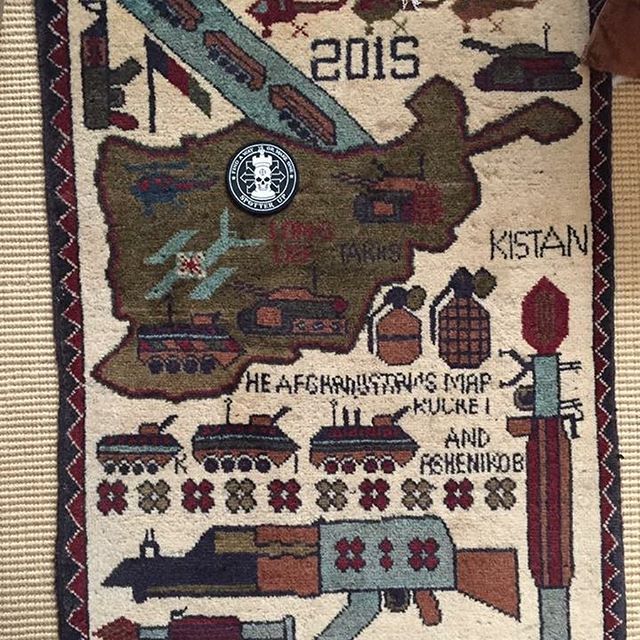
The maps have been redrawn, but some of us remember when SpotterUp held a sizable chunk of Faryab Province. A fiery reign of simultaneous stability and chaos. God bless you Charlie and Doogie. We will never forget the days of getting strapped and takin names. (Fist pumps in the air) Long live the resistance! Spotterup lives!
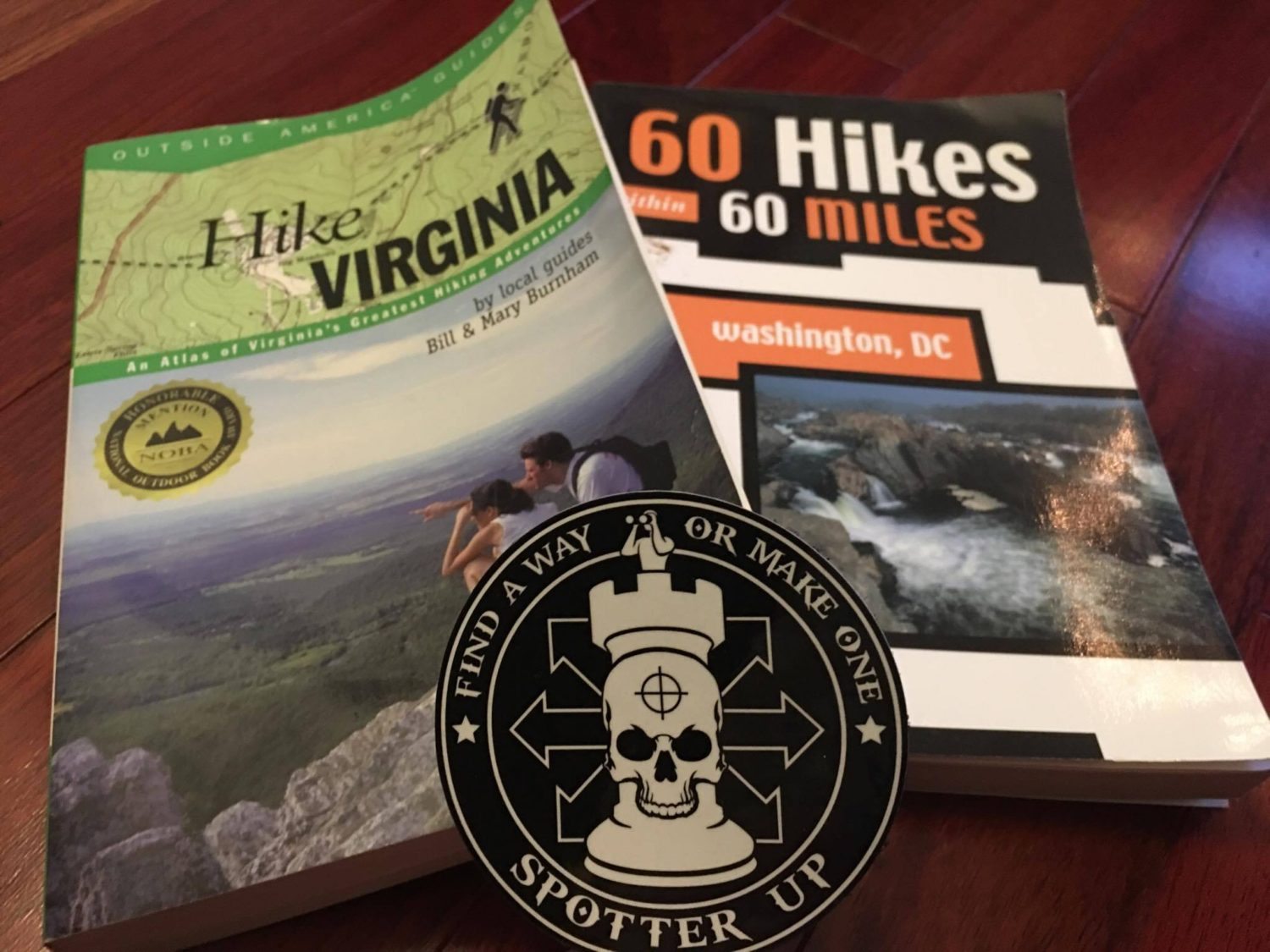
The maps suitable for most general purposes will be Geographic Maps and Tourist Road Maps as these maps give an overall idea of the mapped area in relation to roads, climate, relief, population, vegetation, and hydrography. A tourist map is good for traveling and hiking and finding the general location of major urban areas.
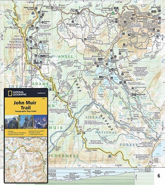
- Geographic Trail Maps: Geographic Maps includes trail maps. Trail maps are trusted and popular recreation maps and contain recreational points of interest, navigational aids, detailed topographic information, and clearly marked trails. Before these maps are made the publisher usually works with the local land manager to ensure accuracy. These kinds of maps go under a rigorous review process and any necessary enhancements are made before being printed. Maps are not infallible and so it is important to have the most current map on hand. A color marking showing a clearing may no longer be there because the clearing could have developed thick brush or forested areas may have been cleared. Look for a good trail map with topographical features such as lakes, streams and rivers and major roadways.

- Tourist Travel Maps: Tourist Maps includes travel maps and destination maps. Travel maps are for locating popular historical and cultural destination cities and buildings (museums, universities, Milan, Paris), popular natural locations (beaches, canyons, known mountain peaks), and comprehensive road network and markings. Destination maps give you precious information about particular areas of interest such as: the Canadian Rockies, the Caribbean, the Finger Lakes, or Wisconsin’s Door Peninsula. Travel maps and destination maps try to strike the perfect balance between map and guidebook. Look for a detailed city map that is the most current on hand.

Colors
Here are the colors traditionally found on most maps:
- BLACK– Indicates man-made or cultural features: School, Church, Airport, Campground, Cemetery, Campground, Picnic area, Railroad tracks, Power lines, National boundary, etc.
- BROWN – Indicates contour lines and elevation numbers.
- BLUE – Identifies Water features such as streams, rapids, springs, marshes, lakes, swamps and rivers.
- GREEN – Identifies Vegetation features such as scrubs, woods, orchards, and vineyards.
- RED – Shows populated areas, main roads, and boundaries.
- PURPLE -Denotes revisions that have been made to a map using aerial photos. Such revisions have not been field-checked for accuracy.
For survival purposes you should have as detailed of a map as you can understand. Travelers often go out with the intent of enjoying themselves but do not often prepare for worst case situations. If there is rioting in a foreign city, a map with good detail will show you how to navigate around construction or clogged traffic, until things die down. A good city map will show you alternate routes out of the city.
Do not solely rely on direction and aid from the nation you are staying in. Their focus is to gain calm before they provide assistance to those in need. A good topographical map will show the current water sources such as lakes and streams and alternate routes or water sources. A landslide and blocked pathway will require you to double-back and find another path around the mess.
When purchasing a map, look for it to be lightweight, packable, and easy to fit in your pocket. Look for maps that are printed on durable, waterproof, tear-resistant material. Double-sided maps will have more printable surface area to provide additional details and useful travel information.
In additional articles we will go more in depth with what are contour lines, land navigation and how to read different types of military maps.